Jellystone Campground to Kings Bridge Park, 8.9 km
To Fort Erie, 28km
Back To Jellystone Campground, 32km
Beautiful trail on the Niagara River, on the section to Fort Erie. Otherwise, the roads were quite calm except for the bit around Marineland.
Fun schooling around the world
Jellystone Campground to Kings Bridge Park, 8.9 km
To Fort Erie, 28km
Back To Jellystone Campground, 32km
Beautiful trail on the Niagara River, on the section to Fort Erie. Otherwise, the roads were quite calm except for the bit around Marineland.
Saskatoon to Saskatoon ViaRail Station, 10km
Saskatoon ViaRail Station to Host, 10km
Edmonton SW – Edmonton Via Rail Station, 26km
We cycled from our hosts’ house to the rail station mainly on city sidewalks (shared trail with pedestrians) and dedicated bike trails. A nice evening ride!
Banff (Tunnel Mountain Village Campground) – Canmore, 26km
This section was mainly on the Legacy Trail, along Hwy 1. A lot of people warned us about a problematic grizzly bear in the zones without fences, but luckily we didn’t see it. Most of the trail IS protected by electrified fences. This part of the trail is paved – a nice ride, and quite scenic as well.
Johnston Canyon Campground – Tunnel Mountain Village (Banff), 32km
We continued on the Bow Valley Parkway and at the end of it, we found the Legacy Trail for the last 9 km to Banff. Easy ride and beautiful trail into town. For the last 4km to the Tunnel Mountain Village 1 Campground there was an unexpected uphill to finish off the day.
Lake Louise – Johnston Canyon Campground, 37km
We decided to take the Bow Valley Parkway toward Banff. Also known as route 1A, this quiet road is excellent for cycling and has quite a few points of interest (to enjoy some nice views of the Bow River and surrounding mountains, as well as a few small cafés/mini markets). Easy ride with a few hills, but nothing serious.
Mosquito Creek Campground – Lake Louise Campground, 30km
Rolling hills and beautiful ride into Lake Louise. “Icefields Parkway” = done ✅ !!
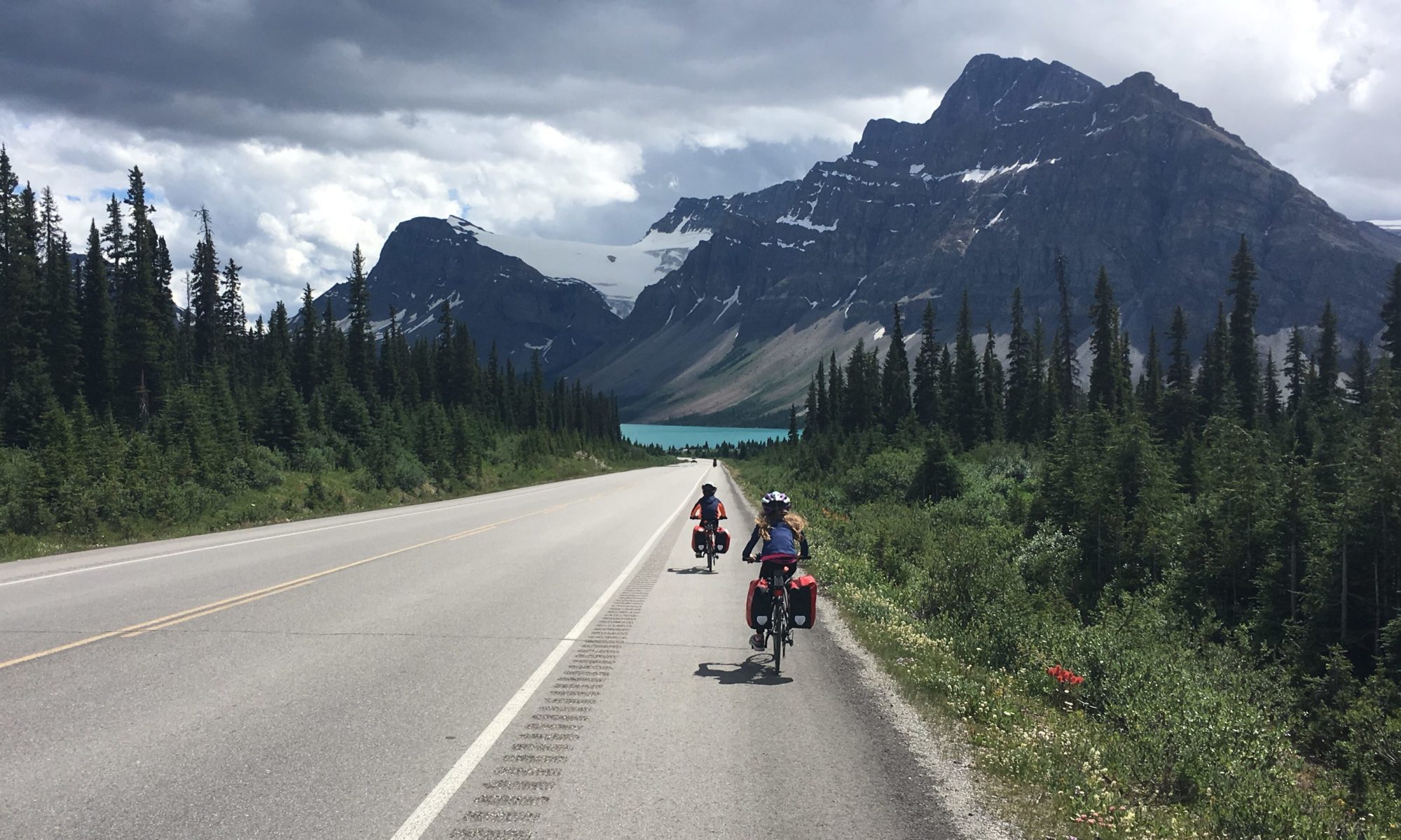
Waterfowl Lakes Campground – Mosquito Creek Campground, 34km
The most challenging section of the trip so far. We started with a gradual climb toward Bow Pass that lasted for about 20km of which the last 7km were quite steep (I’m approximating 6-7% grade). From the highest point of the pass (2080m) to Mosquito Creek the road was truly spectacular and an easy ride. After the Bow Pass climb, everything else seemed easy! 🙂
Rampart Creek Campground – Waterfowl Lakes Campground, 35km
Mostly rolling hills but a nice uphill of a few km awaited us after the Saskatchewan River Crossing. Then, a spectacular descent to the Waterfowl Lakes area rewarded us with beautiful views to finish off the day.